HLYBOKA DISTRICT
Hlyboka district is located in the southern part of Chernivtsi oblast covering the area of 686 sq. km. The district borders on Rumania in the South, Storozhynets district of Chernivtsi oblast in the West and Hertsa district of Chernivtsi oblast in the East. The administrative center is Hlyboka settlement.
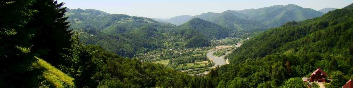
The district terrain was influenced by the Siret river and its tributaries. In the valley of Derelui River near Chervona Dibrova and Valia Kuzmin villages you can find a number of landslide plots shaped as impressive amphitheatres. The Kyrylivskiy hill, located to the South-West from Kamianka village is the highest point of hills in Hlyboka district (478m above sea level). The district climate varies widely with cold winters and warm and moderately humid summers. Temperatures can drop to as low as -32°C in the winter and rise to +35°C in the summer.
The largest waterways are the Siret river and the Small Siret, its tributary. The Siret flows in the South-Western part of the district with its length within the district borders limited to 31 km.
Terrain features make Hlyboka district a foothill zone. It is situated in the country between the two rivers of Prut and Siret.
Beech woods are widely spread over the district territory. Rare plants grow here, such as saffron, lycopodium, lady's slipper, beladonna, etc.
The fauna of the district includes both prairie and mountain species. Brown hare, fox, jay, chaffinch, hawk, falcon can be found here. A substantial part of the above species are registered in The Red Book of Ukraine.
HLYBOKA FROM THE SPACE